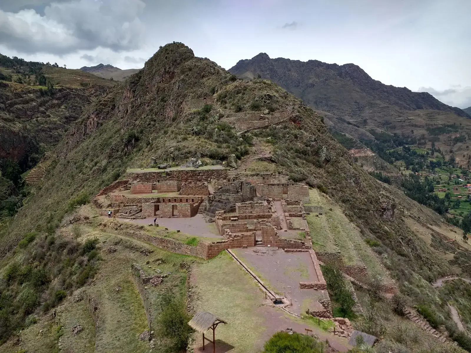
The Pisac ruins are an Inca complex on a narrow ridge about 500 m above the town, at roughly 3,450-3,500 m. Allow two to three hours on site. Most visitors take a taxi up to the upper entrance and walk the circuit downhill, ideally in the morning, before the town market gets busy.
The terraces are the part everyone remembers, but the ceremonial Intihuatana sector and the view across the gorge to the cliff-side tombs are what set Pisac apart from the other valley sites.
Map
What the site is
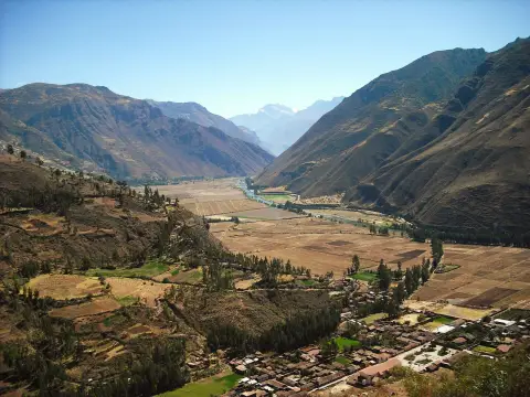
The complex sits on a ridge about a kilometre long, between two small rivers that run down to the Vilcanota, above the town of Pisac. Scholars generally credit the emperor Pachacuti with building it in the mid-15th century, and they see it as a mix of royal estate, ceremonial centre, lookout and farming settlement. Its exact purpose is not fully known, and no Spanish chronicler describes it, so be wary of any single neat explanation.
It is not one monument but a string of sectors along the ridge. Guides usually name seven: Qanchis Racay, Qallaq'asa, Inca Qonqorina, the Intihuatana, P'isaqa, Hospitalniyoc and Kanchis Racay. The names are mostly modern labels, because the original ones are lost. The whole complex covers around 65 hectares, so it is far larger than the small area most people actually walk.
The terraces
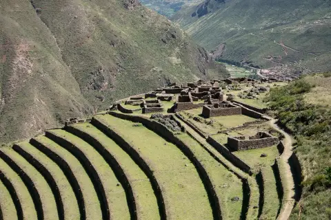
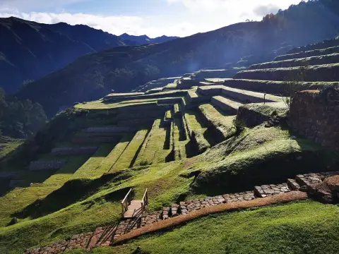
The curving agricultural terraces are the signature view. There are around 500 of them, some up to about 6 m high, following the contours of the slope in long arcs and dropping towards the valley floor. The retaining walls are fieldstone with gravel behind for drainage, which kept the slope from sliding in the rains.
They also worked as a heat store. The stone absorbs warmth by day and releases it at night, which protects roots from frost, and one study cited on Wikipedia found the terraced ground about 3 degrees warmer. That allowed crops to grow higher than they otherwise could. The lowest terraces, close to the town, are still farmed, so you are looking at living agriculture and not only ruins.
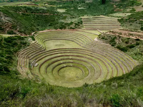
The same technique is easier to compare at Moray and Ollantaytambo, where terraces also climb a hillside, but nowhere in the valley are they as long and as sweeping as at Pisac.
Tours and activities
Bookable online, chosen for their traveller reviews.
-
★ Top rated From €23 per person
-
★ Top rated From €22 per person
-
★ Top rated From €23 per person
-
★ Top rated From €17 per person
The Intihuatana sector
The Intihuatana is the ceremonial heart of the site, set on a small ridge with views down both sides. Its centre is a carved rock, whose name is usually translated as the "hitching post of the sun", and it is thought to have served for tracking the sun through the year. Beside it stands a semicircular building with a straight wall of fine pinkish granite blocks, and nearby are several ceremonial baths fed by channels.
The stonework here is the best on the site: tight joints, smooth faces, a sharp contrast with the rough fieldstone of the residential sectors. Expect to look from a path or platform, as access to the carved rock itself has been restricted at times after damage. Check on arrival what can be approached.
Getting between sectors involves a short rock-cut tunnel, only wide enough for one person at a time. Stop to let people pass, and take care on the steps, which are uneven and worn.
The tombs across the gorge
Look across the river gorge from the ridge and you will see the face of a steep cliff pocked with small holes. These are the tombs of Tankanamarka (also written T'antana Marka), one of the largest pre-Columbian cemeteries in the region. Estimates run from several thousand tombs to many more, and the real number is unclear because looters opened most of them after the Spanish arrived.
You cannot visit them, and you should not try to. They are seen from the site paths, usually as a distant pattern on the rock, so a pair of binoculars or a phone with a good zoom helps. For a traveller they are a useful reminder that Pisac was a place of burial and ritual and not only of farming and defence.
Getting up and getting down
The ruins are well above the town. The common plan is to take a taxi up the road from Pisac to the upper entrance, which saves the steepest climb, and then walk down through the sectors and the terraces to the town. A steep footpath from the town to the ruins also exists, but it is a hard climb at altitude, so walkers should be fit, acclimatised and start early. Ask locally whether the path is open, because routes have been closed in the past.
From Cusco the town is roughly an hour by road; see Cusco to the Sacred Valley for the options. Many Sacred Valley tours include the ruins as a morning stop, with the market after, but a tour often means a fixed and shorter visit. If you want to walk the whole circuit, arrange your own transport and a driver who will drop you at the top.
How long, and when to go
Allow two to three hours for a comfortable circuit, more with a guide who explains the sectors, and less if you only visit the main viewpoints. The walk down to the town adds time on top of that. An early start suits the site best: the light on the terraces is softer, the air is cooler, and the larger tour groups tend to arrive later in the morning.
The dry season, roughly May to September, gives the clearest views and the driest paths. In the rainy months, roughly November to March, the stone steps and the terrace edges are slippery and cloud can hide the valley. The 24 August celebration of Willka Raymi is held at the site each year, which can mean crowds and changes to access that day.
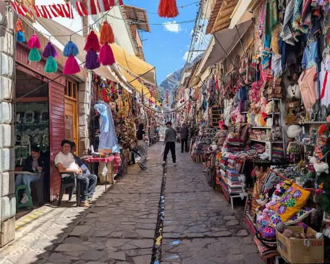
Combine the visit with the craft market in the square below, but note the market is busiest on certain days, and the ruins in the morning followed by lunch in town is the natural order.
Altitude, effort and what to bring
The upper sectors lie at about 3,450-3,500 m, higher than the town and similar to Cusco. The steps and slopes are steady but not technical, and the effort mostly comes from the altitude and the stairs. If you have just flown in, go slowly and read about altitude sickness before choosing how much to do.
There is little shade and the sun is strong, and the wind on the ridge can be cold. Bring a hat, sun protection, a warm layer, a rain jacket in the wet months and water, since there are few places to buy any on the upper paths. Wear shoes with grip, because the stone is smooth where many feet have passed. The packing list covers the basics. Drops are not always fenced, so keep children close and stay on the paths.
Pisac ruins compared with other sites
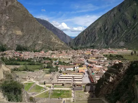
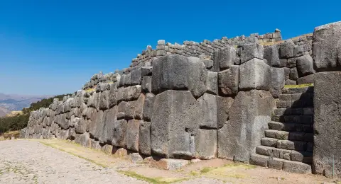
Pisac suits travellers who like walking and views. Compared with Ollantaytambo, it has fewer large buildings and more landscape: you spend most of the visit on terraces and ridge paths. Compared with Sacsayhuamán, above Cusco, it is more rural and the setting is wilder.
If you have time for only one site in the valley and you prefer architecture, Ollantaytambo is the stronger pick. If you want the sweeping terraces and an easy link with a market morning, choose Pisac. Both fit in two days based in the valley; see where to stay in the Sacred Valley to decide where to sleep.
Where to sleep
-
Find hotels
Pisac
Market days, ruins and an easy half-day from Cusco
Frequently asked questions
How long does it take to visit the Pisac ruins?
Two to three hours is a comfortable circuit from the upper entrance, and the walk down to the town adds more. Guided half-day tours are often shorter than that, so ask what the stop includes.
Can I walk up from the town of Pisac?
A footpath climbs from the town, but it is steep and long at altitude, and routes have been closed at times. Most visitors take a taxi up and walk down. If you plan to climb, start early and ask locally whether the path is open.
Do I need a ticket for the Pisac ruins?
Entry has generally been covered by the Cusco regional tourist ticket, not sold as a single-site ticket. Check the current ticket rules before you go, and see the Sacred Valley tours page for what guided days include.
Is the ruins visit better in the morning or afternoon?
Morning, usually. The light is softer, the paths are cooler and groups arrive later. Afternoon visits can work if you want the market first, but allow enough daylight for the walk down.
Can I visit the cliff tombs?
No. The tombs at Tankanamarka are on the far side of the gorge and are not open to visitors, so you see them from the ruins. They are one of the largest burial areas of the region, but most were looted long ago.
Is the walk hard for someone not used to altitude?
The paths are not technical, but the height of about 3,450-3,500 m and the stairs make it tiring if you have just arrived. Take it slowly, drink water and see altitude sickness.
Can I do the ruins and the market on the same day?
Yes, and that is the usual plan: ruins in the morning, then the craft market and lunch in the town square. The market is busiest on certain days, so check which. The town itself is covered in Pisac.