The Llanganuco Lakes are two turquoise lakes, Chinancocha and Orconcocha, at about 3,850 m in a glacial valley of Huascarán National Park. They are reached by a long day trip from Huaraz, usually via Yungay, and need little walking, which makes them the easiest high-altitude scenery in the Cordillera Blanca. Allow a full day, go in the dry season and spend a few days in Huaraz first, because the altitude is higher than the city.
Map
What the Llanganuco Lakes are
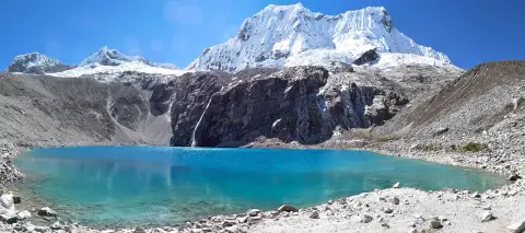
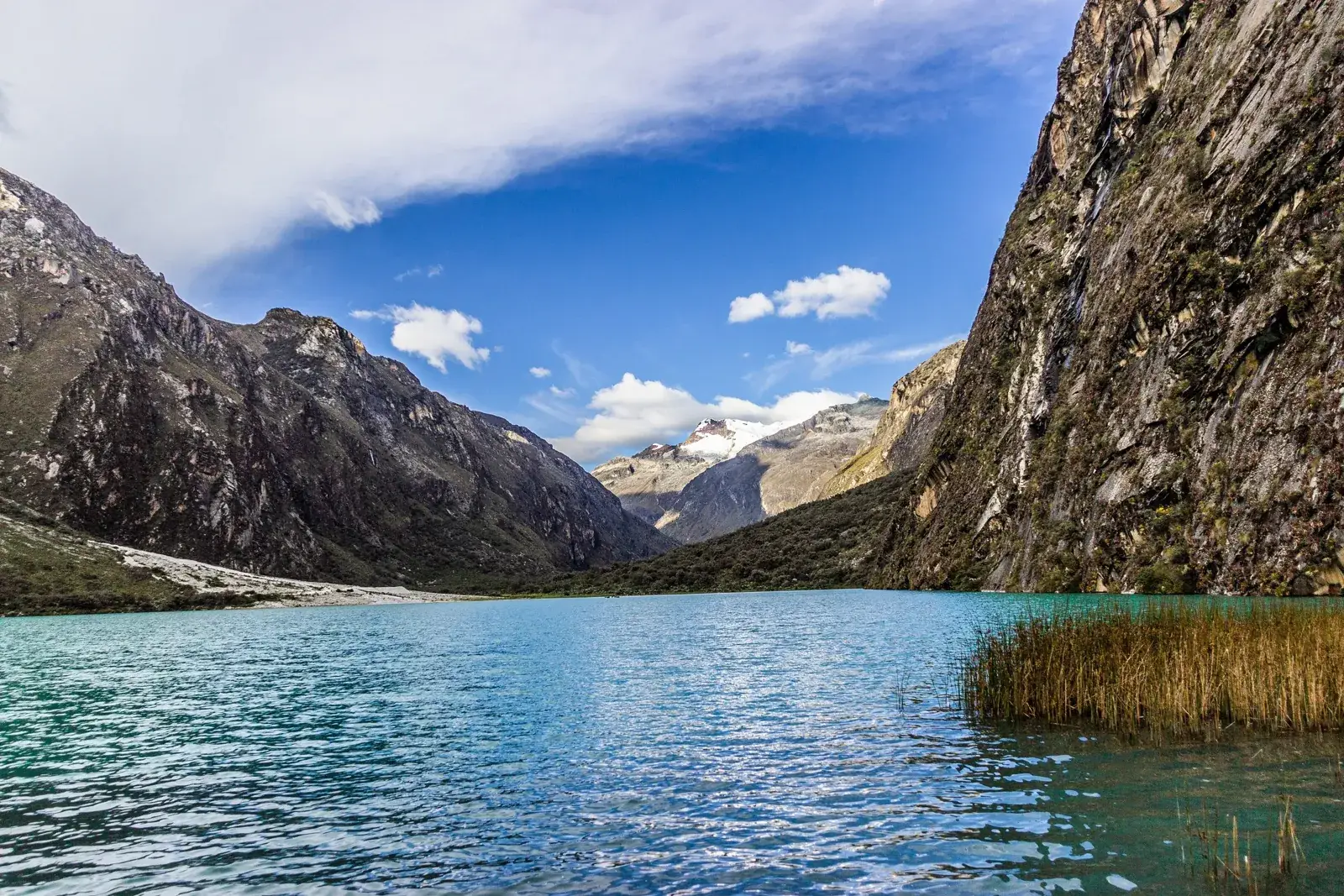
The Llanganuco Lakes lie in the Cordillera Blanca, in Yungay province of the Ancash region, inside Huascarán National Park. There are two main lakes at the head of a U-shaped glacial valley: Chinancocha, the lower and larger one, and Orconcocha, about a kilometre further up. Both sit at roughly 3,850 m, nearly 800 m above Huaraz.
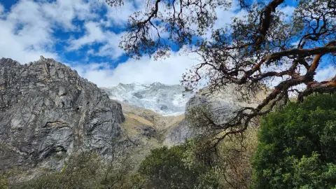
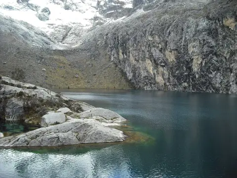
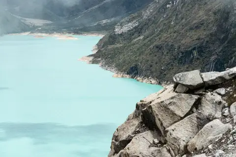
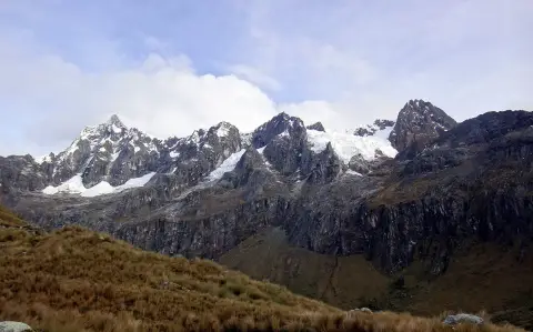
The water is a strong turquoise, the colour that comes from fine rock flour carried down by glacier meltwater, and it changes with the light and the cloud. Steep slopes rise on both sides, and at the valley head the glaciated walls of the highest peaks of the range close the view. The names are usually explained from Quechua: Chinancocha as the female lake and Orconcocha as the male lake, though such etymologies are interpretations.
Many visitors come only to see these lakes, which is reasonable. They are the least demanding way to stand close to the big glaciated peaks without a multi-day trek or a hard ascent.
History and the 1970 earthquake
The valley is a natural corridor between the Callejón de Huaylas and the eastern side of the Cordillera Blanca, and a mountain pass at its top has long linked the two. The lakes themselves formed behind natural dams of glacial debris, which is typical of the range, where retreating ice left basins that filled with meltwater.
The best-known event in recent history is the earthquake of 31 May 1970, which triggered an avalanche from the slopes of Huascarán that buried much of the town of Yungay. The same earthquake is reported to have created a third, much smaller lake between the two main ones, a reminder that this is an active mountain landscape. If you are passing through Yungay, the old town site, now a memorial, helps explain why the valley matters in Peruvian memory, and why guides and drivers in the area speak about the mountains with respect.
Today the lakes are managed as part of the national park, and local communities take part in running activities such as boat rides on Chinancocha.
Tours and activities
Bookable online, chosen for their traveller reviews.
-
Day trip From €29 per person
What you see and do at the lakes
Most of a visit is spent on the road at the shore of Chinancocha, where the road runs close to the water and there are viewpoints and short paths. On a clear morning, the reflection of the slopes and the glaciers above is the main attraction, and photographers tend to arrive early for calmer water and softer light.
A short stretch of shoreline path can be walked without any technical difficulty, and small boats operate on Chinancocha, run by a community association. Whether boats are running, and at what price, changes, so ask on the day rather than assuming.
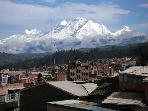
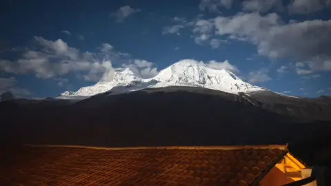
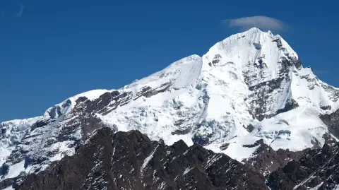
Above the lakes the setting is dominated by Huascarán, at 6,768 m the highest mountain in Peru, and by the neighbouring peaks of the Cordillera Blanca, including Huandoy. They are often partly in cloud, especially from the afternoon, so a clear view is never guaranteed. Orconcocha is further up the valley and quieter, and the wild shrubby woodland on the slopes includes patches of queñua (Polylepis), a high-altitude tree that is worth noticing and leaving alone.
Getting there from Huaraz
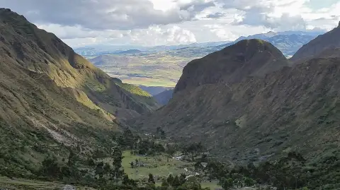
The lakes are normally visited on a full-day tour from Huaraz. The route goes north along the Callejón de Huaylas to Yungay, then climbs a side valley by a winding mountain road to the park control post and the lakes. Sources give the whole trip as a little under three hours each way from Huaraz, with a stop in Yungay, though exact times depend on the road and the traffic.
The road is partly paved and then rough in places, so drivers need an appropriate vehicle, which is a good reason for most travellers to go with a tour. Taxis can be hired from Yungay for those who prefer independence; agree the waiting time and the total price before you set off, and do not expect the driver to know your schedule.
Many tours continue over the high Portachuelo pass above the lakes, at about 4,700 m, which offers wide views of the range on the eastern side. Not every operator includes it, so ask what the itinerary covers. See things to do in Huaraz for how this day fits with other options.
Altitude and health
The lakes sit at about 3,850 m, almost 800 m higher than Huaraz at around 3,050 m. A visitor who has just arrived from Lima, at sea level, can feel the difference quickly: headache, nausea, breathlessness on a short slope and poor sleep are all common. The day trip is easy on the legs but not on the lungs.
The sensible approach is to spend two or three days in Huaraz before coming, with some light walking, and to keep the first days relaxed. The acclimatization guide and the page on altitude sickness explain how to plan this, and when symptoms mean you should descend rather than carry on.
During the day, walk slowly, drink plenty of water and avoid alcohol the night before. If you take regular medication or have a heart, lung or blood condition, talk to a doctor or travel clinic before the trip. Sun protection matters too, because ultraviolet radiation is strong at this height even when the air feels cold.
Best season and time of day
The dry season, roughly May to September, gives the best chance of clear skies and open views of the glaciers, and it is when most tours run. The rainy months, roughly November to March, bring cloud, rain and sometimes disruption on the mountain road, and the peaks are often hidden.
Nights are cold at this altitude in every season, and even in the dry months a morning at the lakes can feel chilly. Temperatures climb during the day, but cloud often builds on the peaks from late morning, so the best views are usually early.
Start early if you can. Tours leave Huaraz in the morning, and the lakes are at their calmest and clearest before the wind rises. Official opening times for the park gate and control post can change, so confirm with your operator rather than relying on a figure from a website. Bring layers, a hat, sun protection, water and a rain jacket whatever the forecast says; the packing list covers the basics.
Combining the lakes with a hike
The Llanganuco road is also the access to some of the best-known hikes in the Cordillera Blanca. The trailhead for Laguna 69 is in the same valley system and is the usual full-day alternative for fit, acclimatised walkers; it is a hard hike at high altitude and not a casual extension of a lake visit.
A different, easier option is a shorter walk along the shore or on the lower paths, which is enough for most people. For a gentler high-altitude lake hike from Huaraz itself, consider Laguna Churup, and for another day trip to a glacial lake in a different valley, see Laguna Parón. Multi-day walkers will meet the same area on the Santa Cruz trek.
If you are choosing between Llanganuco and Laguna 69 for a single day, remember that they are different experiences: the first is a scenic drive with easy walking, the second is a demanding hike.
Practical points and who it suits
Entry is through Huascarán National Park, so there is a park fee, usually paid at the control post, and you should carry cash. Rates for foreign visitors and for residents differ, and rules about guides and the duration of tickets have changed over time, so check current requirements with your operator or the park authority before you go.
The lakes suit almost everyone who is well enough to spend a day at altitude: families, older travellers, photographers and anyone with limited time who wants to see glaciated mountains. They are less suitable for people with serious heart or lung problems, or for pregnant travellers, without medical advice.
Facilities at the lakes are basic. Bring snacks and water, and expect only simple services nearby. Choose an operator carefully, using the advice in how to choose a trekking agency, and consider where to sleep from the Huaraz stay guide. Keep to marked paths, take your rubbish out, and do not pick plants.
Where to sleep
-
Find hotels
Huaraz centre
Services, tour offices and restaurants for the Cordillera Blanca
-
Find hotels
Monterrey
Quieter spot north of town with thermal baths
-
Find hotels
Caraz
Small town closer to the northern lakes and trails
Frequently asked questions
How long does a trip to the Llanganuco Lakes take?
Plan a full day. The drive from Huaraz takes a little under three hours each way according to published sources, and tours add stops in Yungay and at viewpoints. Most people spend one to two hours at the lakes themselves.
How high are the Llanganuco Lakes?
About 3,850 m above sea level, almost 800 m higher than Huaraz. That is high enough to cause altitude symptoms in people who have not acclimatised, so spend a couple of days in the city first. See altitude sickness.
Can I visit the Llanganuco Lakes without a tour?
Yes, in principle, by hiring a taxi from Huaraz or Yungay, but the mountain road needs a suitable vehicle and public transport to the lakes is limited. If you go independently, agree the waiting time and total price in advance and check park entry rules.
Do I need to pay an entrance fee?
The lakes are inside Huascarán National Park, which charges an entrance fee that is normally paid at the control post. Fees differ for foreign and Peruvian visitors and can change, so confirm the current rate and payment method before you travel.
What is the difference between Chinancocha and Orconcocha?
Chinancocha is the lower, larger lake beside the road, and is the one in most photographs. Orconcocha is further up the valley, smaller and quieter. Both have the same turquoise colour.
Is Llanganuco or Laguna 69 better?
They suit different people. Llanganuco is a scenic day with little walking; Laguna 69 is a long, hard hike to a single lake. If you are not fully acclimatised or fit, choose Llanganuco.
When is the best time to go?
The dry season, roughly May to September, gives the clearest views. Go early in the day, because cloud often covers the peaks later. In the rainy season, expect cloud and a more difficult road.