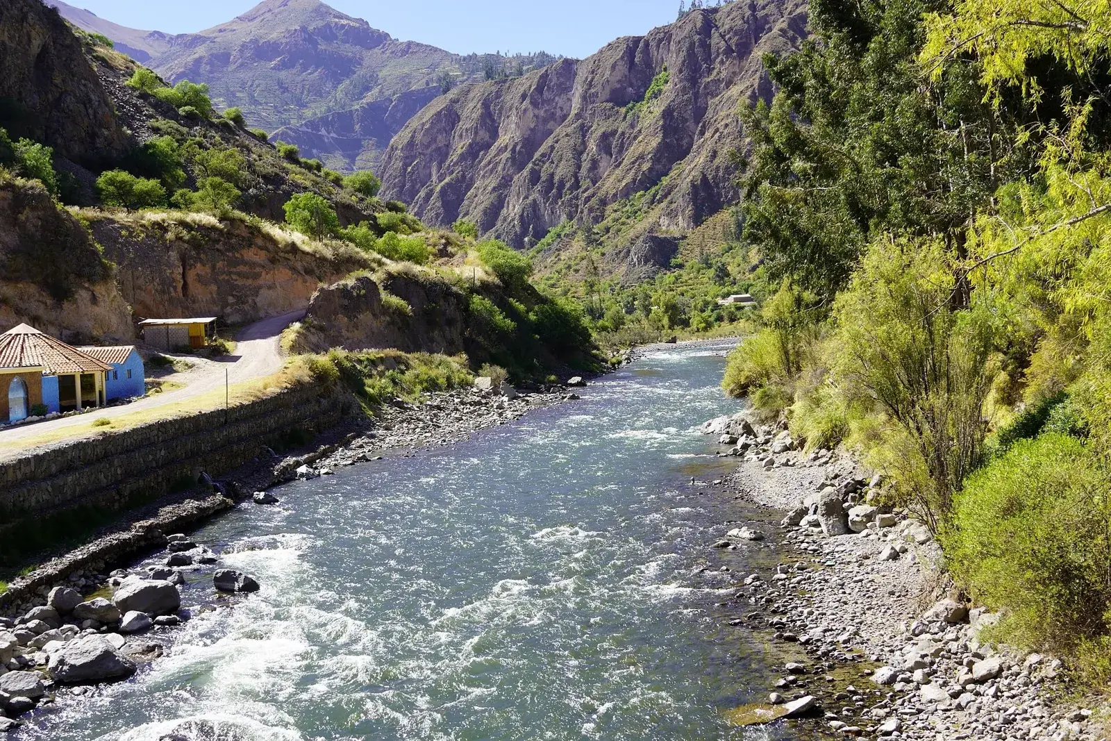
The Cotahuasi Scenic Reserve, officially the Cotahuasi Subbasin Landscape Reserve, is the protected area that surrounds the Cotahuasi river and its canyon in the Arequipa region. It covers roughly 4,900 square kilometres, far more than the gorge itself, and protects a working landscape of terraces, villages and high Andean grassland rather than a single sight.
There is no gate, no single entrance and no circuit to follow. You visit the reserve by travelling the canyon road, so plan it as part of the Cotahuasi trip described on the destination page, with at least four or five days from Arequipa.
Map
What the reserve is
The Cotahuasi Subbasin Landscape Reserve (in Spanish, Reserva Paisajística Subcuenca del Cotahuasi) was created by a national decree in 2005 and covers about 4,905 square kilometres in the province of La Unión, in the Arequipa region. In the international classification of protected areas it belongs to the category of protected landscapes, meaning land where people and nature have shaped each other over a long time, as opposed to a strict nature reserve where people are kept out.
That distinction matters to a visitor. Villages, fields and roads lie inside the boundaries, and the people who farm the terraces are the reason the landscape looks as it does. The reserve is also larger than most people expect: the famous gorge is only one part of it, and the protected area reaches up to the cold, treeless plateau above, where the river begins.
If you want the broader picture of the trip, with villages, waterfalls and logistics, read the Cotahuasi Canyon page first. This page is about the protected area itself and how to read the landscape.
Canyon, subbasin and reserve: three names, one place
The words are used loosely, so it helps to separate them. The Cotahuasi river rises on the high plateau, runs down through the gorge and later joins another river to form the Ocoña, which reaches the Pacific. The canyon is the deep cut the river makes between the mountain massifs of Coropuna (about 6,425 m) and Solimana (about 6,093 m). The subbasin is the whole drainage area that feeds that river, including side valleys and high ground. The reserve follows that watershed.
Quoted depths for the canyon are often around 3,350 m, measured from the river up to the summit of a neighbouring mountain, which makes it one of the deepest in the world. Such comparisons depend on where you measure, so treat the figure as an indication, not a record you can check on site. From the road you will not see the whole drop at once; the sense of depth comes from the valley walls rising for hours on either side as you travel.
The reserve's own description speaks of around a dozen ecosystems, from dry canyon floor to high puna, and that range is what you notice on the road.
What you actually see inside it
Because the reserve is a landscape and not a single monument, what you see is a sequence. On the canyon floor the climate is warm and dry, with irrigated fields, fruit trees and cactus on the slopes. Higher up, agricultural terraces climb the hillsides, many of them still farmed and some of pre-Inca or Inca origin, which is why people describe the area as an inhabited museum of terracing. Stone villages with colonial churches sit on ledges above the river, and old paths link them.
Above the farmland the vegetation thins into puna, high grassland used for grazing alpacas and llamas, with lakes, bofedales (wet meadows) and the volcanic bulk of Coropuna on the horizon. The contrast between the floor and the plateau, covered in a single day, is the strongest impression the reserve gives.
Waterfalls and hot springs are part of the same system, because the volcanic ground feeds both. The best known fall and the thermal baths are covered on the destination page, and you should confirm locally which ones can currently be reached.
Getting there from Arequipa
There is one main road into the canyon, and it runs from the coastal Panamericana up through Aplao and Chuquibamba to the town of Cotahuasi, which works as the reserve's practical centre. Bus companies serve the route from the Arequipa terminal. The journey is commonly reported at 10 to 12 hours, and the road is unpaved after Chuquibamba, so delays after rain are normal.
Do not treat the reserve like Colca, which sits on a shorter, better road and has many hotels. For the neighbouring canyon the practical guide is Arequipa to Colca, a quite different undertaking. Cotahuasi needs more time and a looser schedule.
If you prefer a prepared trip, some agencies in Arequipa arrange multi-day departures; see Arequipa tours for what to ask. Confirm the current bus companies, departure times and the state of the road before you buy anything, since all three change.
Access, fees and rules
Entry arrangements are the least certain part of a visit. Peru's protected areas are managed by the national protected-areas service, and some reserves charge an entrance fee or ask visitors to register, while others leave access free. For this landscape reserve, which is mostly open land and villages, it is not clear that a formal ticket system operates along the whole road. Ask your lodging in Cotahuasi town and any guide, and do not rely on a figure found online.
Some general rules apply anywhere in the reserve. Stay on existing paths across terraces, because walls are fragile and the fields belong to families. Ask before photographing people. Take rubbish with you, since collection in small villages is limited. Do not remove stones or plants, and keep away from animals grazing on the puna.
For longer walks or river activities, ask whether a local guide or a permit is needed. Local people and the municipal offices in Cotahuasi know the current rules better than any guidebook.
Altitude and effort
The altitude range inside the reserve is wide. Cotahuasi town lies at about 2,600 m, the canyon floor further down is lower and warmer, and the high puna and mountain passes pass 4,000 m. You can therefore gain or lose well over a thousand metres in a single day by road, which is a quick way to feel unwell if you arrive straight from the coast.
Spend a night or two in Arequipa, at about 2,330 m, before the long drive, and read about altitude sickness. Headache and breathlessness on the upper stretches are common, so drink water and avoid heavy effort on the first day.
The effort of the visit itself is mostly sitting in vehicles. Walks between villages or to viewpoints are short to moderate, but terrain is steep and uneven. Sun at altitude is strong and the canyon floor can be hot, while the plateau is cold, so pack layers and sun protection. A list of what to carry is in trekking gear.
When to go
The dry season, roughly May to September, is the sensible choice. Roads are more reliable, skies are clearer and the views along the canyon are at their best. See dry season for how the Andean year works. Nights on the plateau are coldest around June and July.
The wet months, roughly November to March, turn the slopes green and fill the waterfalls, but they also bring landslides on the single access road. With so little transport on offer, a blocked road can cost you days. If you travel then, keep the end of the trip flexible and ask about road conditions before leaving Arequipa.
Village festivals, often tied to saints' days, are worth knowing about. They bring colour and music, but also full lodgings and reduced services. Ask your host about dates when you plan the trip.
Who it suits and what to combine it with
The reserve suits travellers who enjoy landscape and slow travel: people who would rather watch terraces change colour from a village square than tick off a monument. Photographers, walkers, birdwatchers and anyone curious about Andean farming will get the most from it. It is a poor fit for short trips, for travellers who need predictable services, or for anyone uncomfortable with long, winding roads.
Cotahuasi pairs well with a longer southern loop. Many visitors see Colca Canyon first, as it is easier, and compare the two; the Colca tour or independent guide shows how much planning that kind of trip needs. The Colca villages are a useful comparison for terraced settlements.
Carry cash, as there is little banking in the area; see money in Peru. For remoteness, insurance and precautions, read staying safe in Peru. Tell your lodging where you are going each day, because mobile coverage is patchy.
Frequently asked questions
Is the Cotahuasi Scenic Reserve the same as Cotahuasi Canyon?
Not exactly. The canyon is the deep gorge cut by the river, while the reserve is the much larger protected area that follows the whole river basin, including villages, terraces and high puna. In practice you visit both at once. The Cotahuasi Canyon page covers the trip itself.
How big is the Cotahuasi Subbasin Landscape Reserve?
About 4,905 square kilometres, according to the figures usually quoted for the protected area. That is much more than the canyon alone and covers several altitude zones. The boundary is not marked in a way a visitor would notice.
Do I need a ticket or permit to enter the reserve?
It is not certain that a formal entrance system operates along the main road, and rules for protected areas can change. Ask your lodging in Cotahuasi town or the local municipality before you set out. Ask again if you plan a long walk or a river trip.
Is there wildlife to see in the reserve?
The varied ecosystems support birds and Andean animals such as grazing camelids on the high plateau, but sightings depend on altitude, season and luck. Go for the landscape first. A local guide can tell you where to look for birds.
Can I visit the reserve in one day from Arequipa?
No. The road journey alone takes most of a day each way, so a single day would be spent on a bus. Allow at least four or five days in total, including time inside the canyon.
Is it possible to camp or trek inside the reserve?
Walking between villages and on old paths is possible, and some guides offer longer treks. Camping rules vary by community land, so ask permission locally and hire a guide for unmarked routes. See trekking gear for what to carry.
Is the reserve safe to visit?
The main risks are remoteness, road conditions and altitude, not crime. Carry insurance that covers evacuation, a first-aid kit and cash, and tell your host your plans. General advice is in staying safe in Peru.