Túcume is a group of 26 adobe pyramids and mounds on a plain about 30-45 minutes by road from Chiclayo, built from around the 11th century by the Lambayeque (Sicán) culture and later taken over by the Chimú and the Inca. Give it half a day: the small site museum first, then the marked trails past Huaca Larga and Huaca Las Balsas, then the short climb to the viewpoint on the hill. Go early, because the plain has almost no shade.
Map
What Túcume is
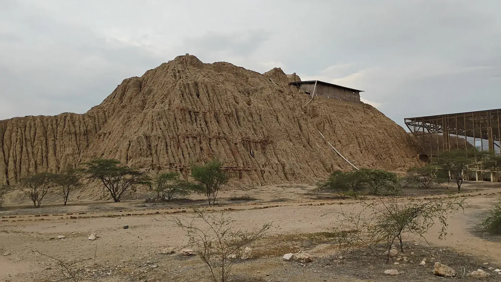
Túcume is one of the largest groups of adobe pyramids in Peru: 26 major structures spread over a plain of roughly 200 hectares in the Lambayeque region, at the foot of a rocky hill called Cerro La Raya, which locals also know as El Purgatorio. The pyramids were built from sun-dried mud brick, and centuries of rain, wind and the occasional El Niño downpour have worn many of them into long, rounded hills. From a distance they look like part of the landscape, and only the straight edges and ramps give them away.
The site is not a single monument but a ceremonial and political centre that grew over several centuries. It is the best place on the north coast to understand what lay between the Moche of the first millennium and the Inca, and it is a natural second stop after the finds at Sipán. The Chiclayo guide shows how both fit into a base stay in the city.
A short history
The site was built from around the 11th century by the Lambayeque, or Sicán, culture, whose power in this valley followed the decline of the Moche. Around the late 14th century the Chimú kingdom, whose capital lay near today's Trujillo, conquered the region and kept using Túcume, adding its own architecture. Around 1470 the Inca brought the valley into their empire, and Inca-period burials have been excavated here. The site was abandoned around the time the Spanish arrived in 1532.
Local tradition links the place to the legend of Naylamp, a founding figure said to have arrived by sea, and curanderos from the region still make offerings on the hill. Sources differ on exact dates and on how the legend relates to the archaeology, so treat the chronology as approximate. What is clear is that Túcume held authority under three successive powers, which is unusual for a single site.
Heyerdahl at Túcume
The site is also known outside Peru because the Norwegian explorer Thor Heyerdahl, famous for the Kon-Tiki raft voyage, led excavations at Túcume in the late 1980s and early 1990s. He worked with the Peruvian archaeologist Alfredo Narváez and the American archaeologist Daniel Sandweiss, and the team's results appeared in a book titled *The Pyramids of Túcume*. Heyerdahl saw the coastal seafaring tradition of this valley as part of his long-running ideas about contact across the Pacific.
Those wider claims are Heyerdahl's own interpretation and are not accepted by most archaeologists, so do not expect the site to prove them. His real legacy here is practical: the project excavated, mapped and drew attention to a site that had been little studied, and it helped lead to the museum and the visitor routes. A guide at the entrance can point out which areas were dug in that period.
What you see on the ground
The largest structure is Huaca Larga, an enormous platform of adobe often described as more than 600 metres long and some 20 metres high, so long that it is easier to understand from the hill or from the site models than from its base. The sources give slightly different dimensions, which is a sign of how worn the mound is. Walking along its flank is the best way to feel the scale.
Huaca Las Balsas is the most rewarding stop. It has been partly excavated and protected, and its mud-relief walls show boats, waves, seabirds, fish and human figures, a reminder of the sea that lay not far to the west. Other mounds, such as Huaca de las Estacas and Huaca Las Abejas, are mostly unexcavated hills, and part of the interest is seeing how much remains buried. The marked routes cross uneven open ground with little signage, so a local guide adds a lot.
The museum and the viewpoint
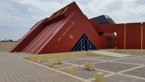
Start at the small site museum near the entrance, which is normally included in the ticket. It holds burial reconstructions, ceramics, textile fragments and scale models of the complex. The models make the later walk much easier to follow, because from ground level the mounds blur into the plain.
Then climb Cerro La Raya for the view. A stepped path leads to a viewpoint at the top, and the climb is usually described as 20 to 30 minutes uphill. From above the grid of pyramids, plazas and enclosures becomes readable, and the green fields and the line of the valley frame the site. Wear shoes with grip, carry water, and avoid the climb in the hottest hours or after rain, when the path can be slippery.
Getting there from Chiclayo
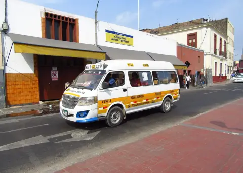
Túcume lies about 30 to 45 minutes by road from Chiclayo, depending on the traffic and the vehicle. The cheapest route is a shared minibus or colectivo from the bus area in Chiclayo or Lambayeque to Túcume town, followed by a short mototaxi to the entrance; see colectivos for how these work. Check the departure point and the last return time locally, because information is hard to find online.
A taxi or a private driver is simpler and lets you combine sites. Fix the fare and the waiting time before leaving, as described in taxis and apps. Many visitors take a half-day or full-day tour that pairs Túcume with the Sicán National Museum in Ferreñafe, or with the museum near Sipán; compare it with going alone in the Chiclayo guide. Long-distance buses to and from the region are covered in buses in Peru.
When to go, heat and effort
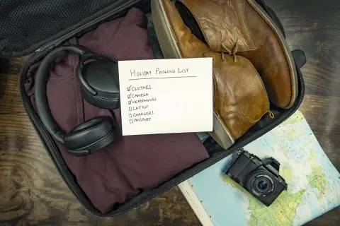
The north coast is hot and dry, and the plain at Túcume offers almost no shade. The dry season from roughly May to October is often recommended, but the early morning is the better choice in any month, both for the light on the adobe and for the temperature. Midday sun can be punishing, so bring a hat, sun protection and plenty of water, and see the packing list for what to carry.
The effort is low to moderate: flat paths, some uneven ground and one climb. There is no altitude issue, since the site lies close to sea level. Access for people with limited mobility is partial because of the unpaved routes. Visiting hours and the closing day, often Monday, change from time to time, so confirm them before you go.
What to combine it with
Túcume pairs naturally with Sipán and the Royal Tombs museum in Lambayeque, which together give a full picture of the region's cultures, and with the Sicán National Museum in Ferreñafe. A half day at Túcume followed by a late lunch back in Chiclayo works well; the northern food guide suggests what to order.
For the onward route, the northern itinerary places Túcume between Trujillo and the highlands of Cajamarca or Chachapoyas. Travellers who like the archaeology can also see the Pómac dry forest and its adobe temples on the same trip. If you buy crafts from vendors near the entrance, souvenirs in Peru explains what to look for.
Where to sleep
-
Find hotels
Chiclayo
Base for the Sipán tombs, pyramids and the north's food
Frequently asked questions
How long do you need at the Túcume pyramids?
Plan two to three hours on site for the museum, the main trails and the viewpoint, plus the travel time from Chiclayo. A half day is comfortable, and a full day lets you add the museum at Sipán or the Sicán museum.
How far is Túcume from Chiclayo?
It is roughly 30 to 45 minutes by road, and published distances vary. Shared minibuses and taxis both make the trip, and the Chiclayo guide lists the other excursions.
Is Túcume worth visiting if I have already seen Sipán?
Yes, because they show different periods and scales. Sipán is about a royal tomb and its finds, while Túcume is a large later city of pyramids that you can walk through and view from a hill.
Can I climb the pyramids?
Walking on the mounds is generally restricted to protect the adobe, and visitors follow marked routes. The climb you can do is the path up Cerro La Raya to the viewpoint, which gives the best overview.
What did Thor Heyerdahl do at Túcume?
He led an excavation project here in the late 1980s and early 1990s with Peruvian and American archaeologists. His Pacific theories are disputed, but the fieldwork documented the site and raised its profile.
Do I need a guide at Túcume?
It is not required, but the mounds are eroded and the signs are limited, so a guide helps you read what you are seeing. Agree the price before the walk and ask whether it covers the whole circuit.
Is there shade and are there facilities?
Shade is scarce on the plain, though the museum building and some paths give relief. Bring your own water and snacks, and check water and food safety before buying drinks from stalls.